
Measured surveys and inspection data you can act on.
From 3D point clouds and 2D drawings to mapped inspection imagery, we give property professionals clear, accurate information at every stage of a project.
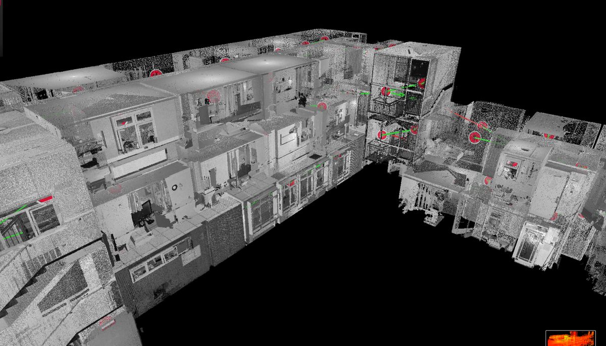
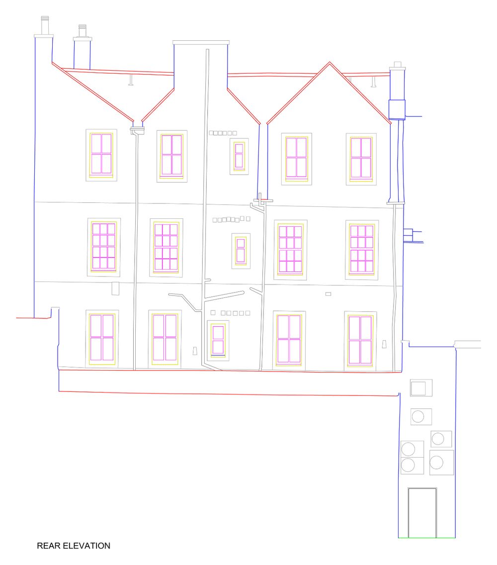
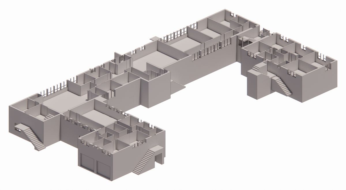
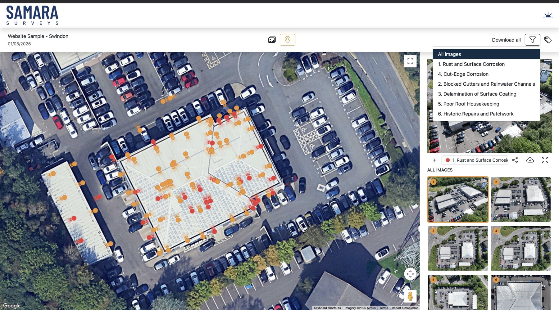
Accurate survey information, in a format you can use.
Measured building surveys, drone inspections and reality capture for property professionals across the UK. Every job is delivered in a structured, repeatable format, from 2D drawings and point clouds to mapped inspection imagery.
Clear, actionable outputs
Findings, defects and areas of interest are easy to pick out, so you can see what matters and decide what happens next.
Consistent reporting
The same structure on every project, presented to a standard you can pass straight to clients and colleagues.
Data on a map
Imagery and survey data sit on our viewing platform, so you can move around a site and review large datasets without folders of files.
Real property experience
A background in property and asset management means the information is shaped around how it will be used on site and in decisions.
One setup at a time.
The scanner turns through a full circle at each set-up, recording millions of points off every wall, window and ceiling it can see. We move it room by room, then register the setups together into one accurate point cloud.
From that point cloud we draw the floor plans, elevations and sections, or build a Revit model.
More on measured surveysMeasure, inspect, share.
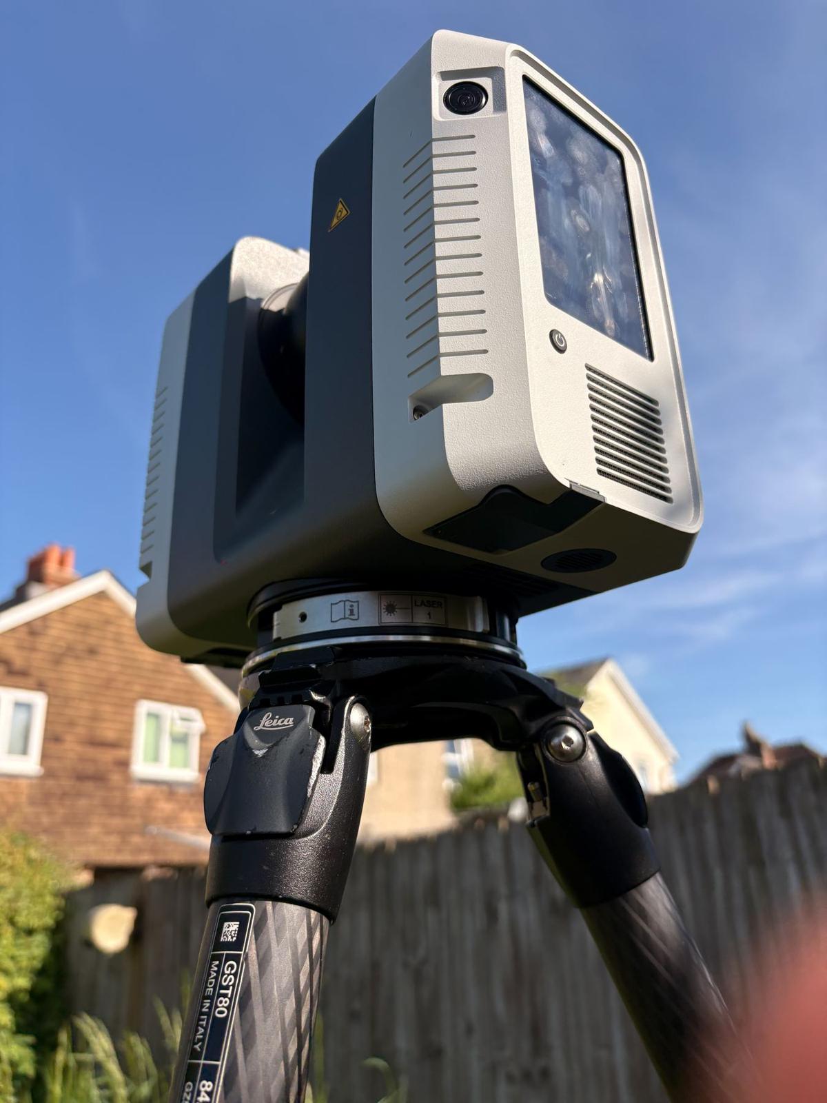

Measured surveys
Laser scanning and drone-supported surveys producing floor plans, elevations, sections, roof plans, point clouds and BIM outputs.
Measured surveys →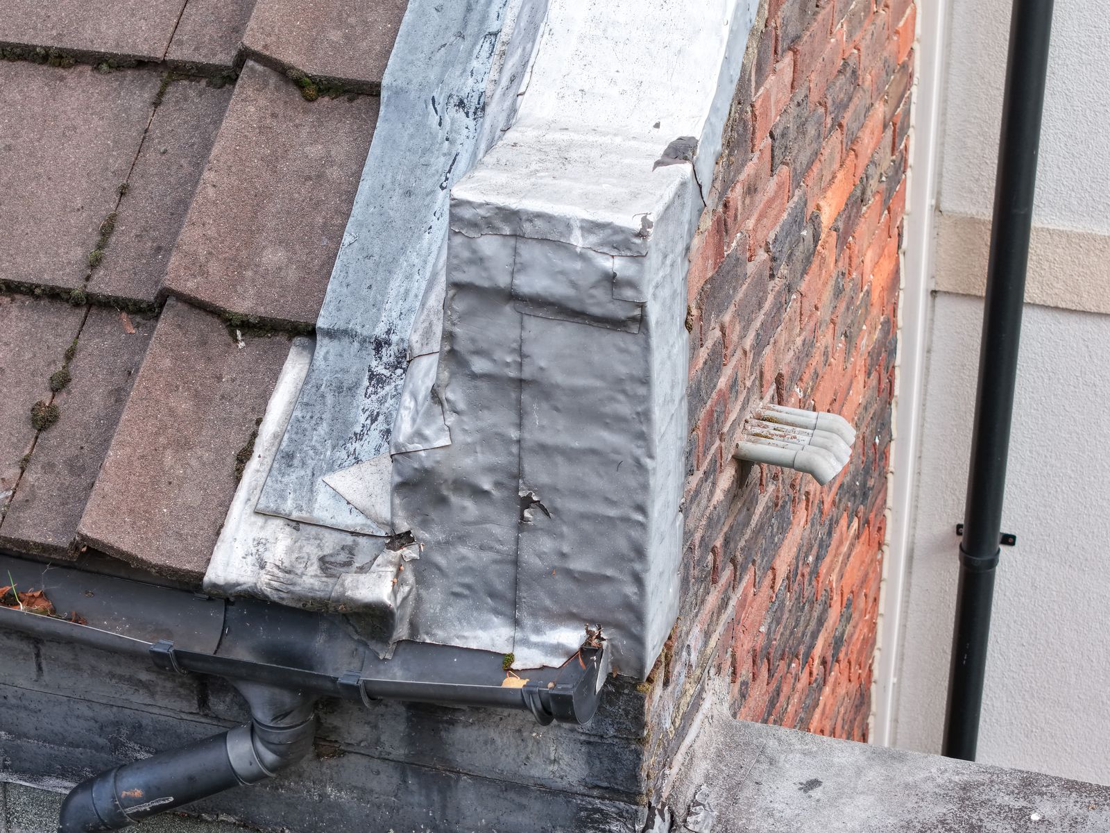

Inspection surveys
Clear, focused drone inspections that pick out what matters across a roof, building or site.
Inspection surveys →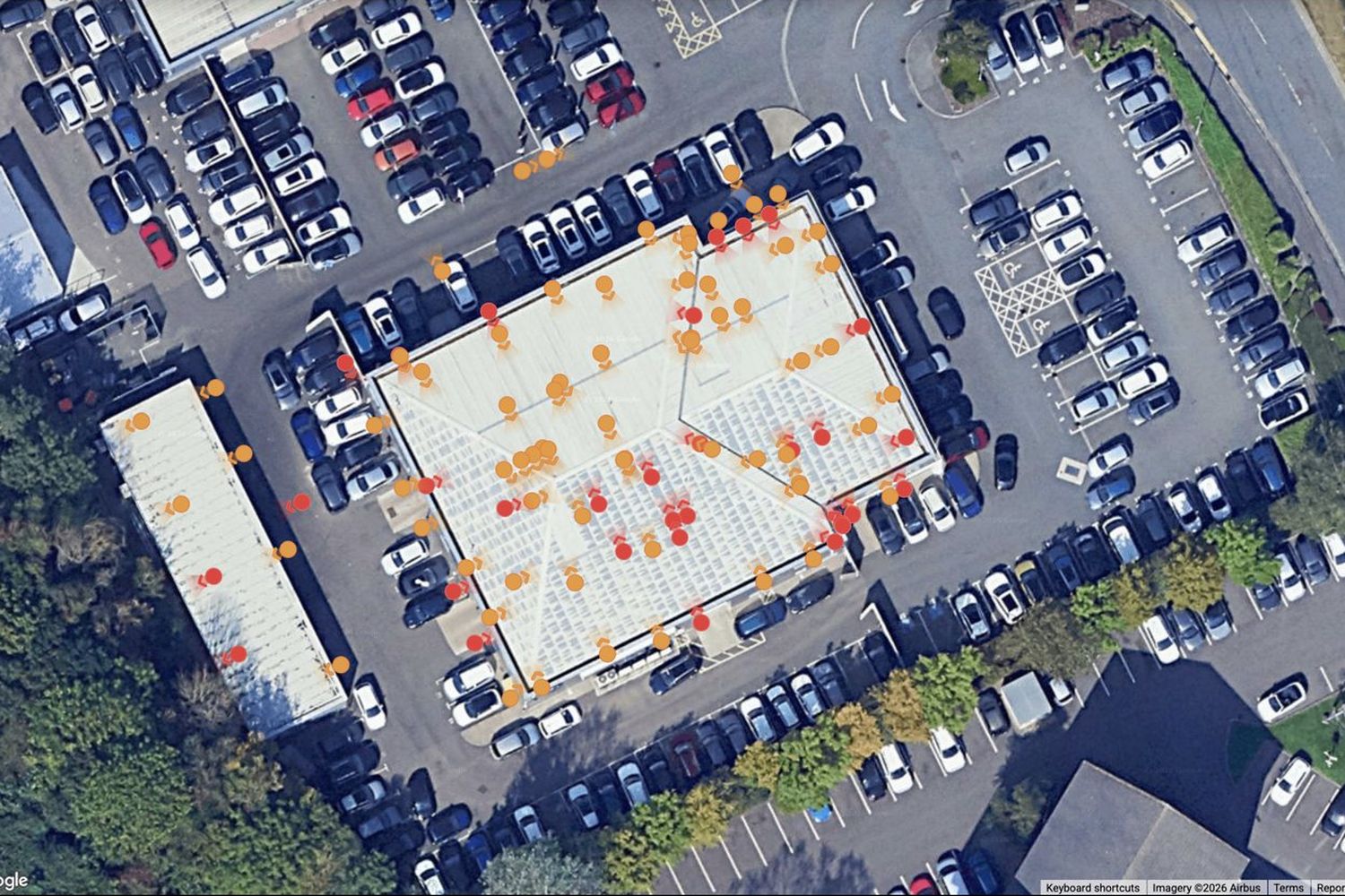

Viewing platform
Mapped, interactive survey data that makes reviewing and sharing information simple. No logins needed.
Viewing platform →Trusted by surveyors, consultants and property teams
- AtkinsRéalis
- Knight Frank
- Colliers
- Faithful+Gould
- Calfordseaden
- Hartnell Taylor Cook
- SHW
- London Boroughs
- COH Surveyors
- MacConvilles
- Gradient Consultants
- Spring Building Consultants
- PA Surveyors
- Philip Hall Associates
- AM Surveying & Block Management
- Elementum Surveying
Common questions
Anything else, call 07974 308 637 or email alex@samarasurveys.co.uk.
What does Samara Surveys do?
Samara Surveys provides measured building surveys, 3D laser scanning and drone roof and building inspections for property professionals. Surveys are delivered as floor plans, elevations, sections, point clouds, 3D models and mapped inspection imagery.
Which areas do you cover?
We are based in Uckfield, East Sussex, and work nationwide, with a focus on London and the South East.
Who do you work with?
Mainly building surveyors, consultants, managing agents, architects and other property professionals who need accurate information about existing buildings.
Is Samara Surveys the same business as Sussex Drone Surveys?
Yes. Samara Surveys was previously Sussex Drone Surveys. The name changed as the work grew beyond Sussex and beyond drones, into laser scanning, measured surveys and 3D data.
Are your drone operations qualified and insured?
Yes. Drone work is carried out under a GVC, PDRA01 and A2 CofC, with project-specific RAMS, public liability insurance and professional indemnity insurance.
Get in touch about your survey
Send the site address and what you need, or call for a chat about the job. We'll come back to you with a quote.
- Phone07974 308 637
- Emailalex@samarasurveys.co.uk
- CoverageNationwide, with a focus on London and the South East
- Office13 Alexandra Road, Uckfield, East Sussex TN22 5BB
Got existing plans or photos? Email them to alex@samarasurveys.co.uk and we'll include them in the quote.